
Mapping the West:
Nineteenth- Century American Landscape Photographs from the Collection of the Boston Public Library
Curated by Kim Sichel

Alexander Gardner, Mushroom Rock on Alum Creek, Kansas, 211 Miles West of Missouri River, 1867, Albumen print.
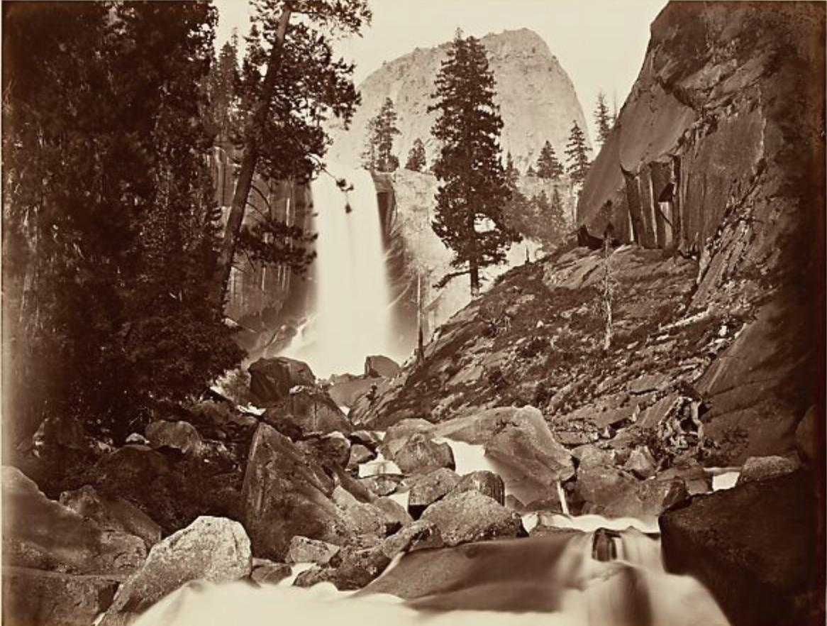
![Carleton Watkins, Piwyac, [or] Vernal Fall and Mt. Broderick, 300 feet, ca. 1865-1886, Albumen Print.](https://images.squarespace-cdn.com/content/v1/6703312dcf01f078fe62867f/30ffaac0-dbb4-4043-8d17-021cd2b6420e/Screen+Shot+2025-06-23+at+2.31.05+PM.png)
Carleton Watkins, Piwyac, [or] Vernal Fall and Mt. Broderick, 300 feet, ca. 1865-1886, Albumen Print.
Creating photographs with the wet-collodion process in the western wilderness after the Civil War was a complex and labor-intensive task. Photographers like Carleton Watkins and Alexander Gardner transported heavy equipment—including large cameras, glass plates, chemicals, and darkroom tents—by mule train to remote locations. The process required coating, exposing, and developing glass negatives on-site while still wet, then carefully transporting the fragile results.
These photographers did not work alone but as part of collaborative ventures funded by various patrons. Their images served multiple roles: as fine art, scientific records, and promotional tools.
Mapping the West highlights four such collaborative projects: Watkins's Yosemite photographs for collectors; Gardner’s images promoting the Kansas Pacific Railroad; Timothy O'Sullivan’s work for government geological surveys; and John K. Hillers’s ethnographic photos for John Wesley Powell’s studies of Native American cultures. Collectively, these visual records shaped the emerging national perception of a “tamed” American West.
WORKS
78
DIMENSIONS
15 x 20 to 25 x 30 (inches)
SPACE REQUIREMENTS
Aprox. 350 linear feet
INQUIRIES
exhibitions@curatorial.org
626.577.0044